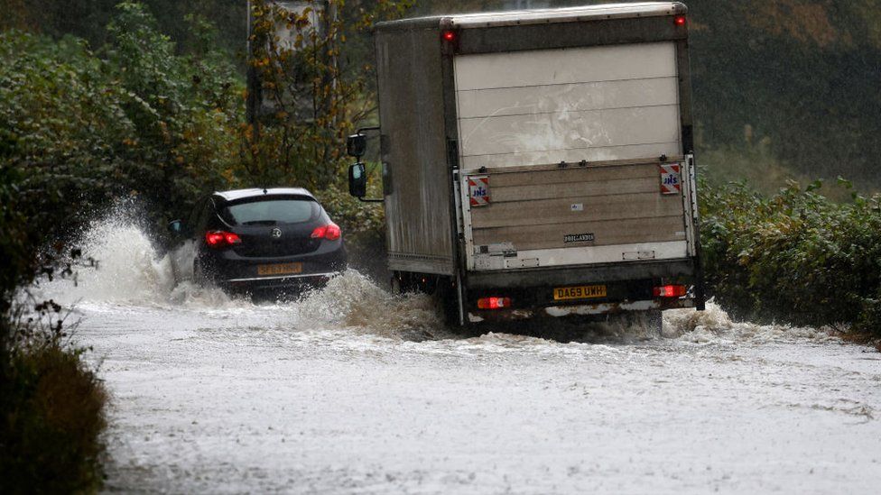
People living in areas covered by a red weather warning in Scotland have been urged to avoid travel and stay at home.
Storm Babet is expected to bring “unprecedented” rainfall, with severe flooding and risk to life on Thursday and Friday.
The worst affected areas are likely to be around Angus and Aberdeenshire.
Yellow severe weather warnings of wind and rain have also been issued for Northern Ireland and northern and eastern areas of England.
The Scottish government’s Resilience Room met on Wednesday evening, with representatives from Transport Scotland and the Scottish Environment Protection Agency (Sepa) attending.
Afterwards Deputy First Minister Shona Robison said: “Red warnings are rarely issued by the Met Office and this reflects how serious the impacts will be from the exceptional weather we can expect – particularly in the north east of Scotland in the next two days.
“The strong message is that if you are in the parts of Angus and South Aberdeenshire affected – please stay at home and do not travel.”
The Met Office weather warning runs from 18:00 on Thursday until noon on Friday, with between 10-15cm (4-6in) of rain expected to fall quite widely within the warning period and some locations likely to see between 20-25cm (8-10in).
The red warning states there is “danger to life from fast flowing or deep floodwater” in Aberdeenshire and Angus, with extensive flooding and road closures also expected.
It is feared there could also be power cuts and that some areas could be cut off for days.
Sepa warned that Storm Babet was forecast to bring “unprecedented” levels of rain to the north east of Scotland, with flooding that would cause “significant disruption and be a danger to life”.
Amber warnings remain in place across other parts of north east Scotland and the Highlands on Thursday and Friday, with yellow warnings covering much of the country through until Saturday.
Many of the affected areas across the UK are still saturated by heavy rain that caused flooding earlier this month. The deluge was said to have been the worst since the 1890s.
ScotRail has already cancelled services on several routes in Scotland on Thursday and Friday.
They are Perth-Aberdeen via Dundee, Perth-Aviemore (Highland main line), Perth-Dunblane, Aberdeen-Elgin (Aberdeen-Inverness line), Tain-Wick/Thurso (Far North line), and Fife Circle services.
The cancellations will also affect services between Glasgow Queen Street and Aberdeen and Inverness, and between Edinburgh Waverley and Aberdeen and Inverness.
Meanwhile, Police Scotland has urged people to avoid any form of travel during the period of the red weather warning. Driving conditions are expected to be extremely dangerous with disruption and significant delays.
Gale-force winds in Wales are expected to cause flooding, power cuts and travel disruption.
Storm Babet, a complex area of low pressure which developed to the west of the Iberian Peninsula, was named by the Met Office on Monday morning.
It is the second named storm of the 2023/24 season, which started in early September, with the naming convention aimed at making it easier for people to engage with weather forecasts.
Rain warnings for every county in the Republic of Ireland were in place overnight, having come into effect at various stages on Tuesday.
Met Office deputy chief meteorologist Tony Wardle said the rain would be accompanied by very strong winds that would bring large waves near some eastern coasts.
The Met Office said the last red warning issued in the UK was for extreme heat in July of last year.
The last UK red warning for rain was in February 2020 in South Wales for Storm Dennis, while the last in Scotland was in December 2015 for Storm Desmond.
ScotRail has warned people travelling on Thursday and Friday to check journeys in advance, with Storm Babet likely to cause disruption to services.

Stein Connelly, from Transport Scotland, said: “We recently witnessed some of the most severe weather in Scotland since the 1890s, and this is looking like another period of extreme weather, which could present a risk to life.
“People need to plan ahead ahead and be prepared. Avoid travel unless essential. If you do need to travel, check before your travel as your journey is likely to be affected by these latest severe weather warnings.
“For those in Angus and south Aberdeenshire, the advice is clear – do not travel during the period the red warning is in effect. The rain is expected to present some really challenging conditions.”
First Minister Humza Yousaf also warned against all but essential travel in the parts of Scotland impacted by the red weather warning.He posted on X – formerly Twitter: “Please be aware of the challenging weather we are due to experience.
“Weather warning across Angus and the north east has been upgraded to red. Travel should be avoided unless absolutely essential.”
He added: “The Scottish government is working with local resilience partners, including our emergency services, to ensure we keep everyone safe & mitigate disruption as best we can.”

Scottish and Southern Electricity Networks (SSEN) said some areas could face gusts of up to 70mph, particularly on eastern coasts. The strongest winds are currently forecast to be on Thursday afternoon and into the early evening.
The energy firm said it was mobilising more teams to deal with any damage to the network and subsequent faults.
Angus Council confirmed that schools in the region will close at lunchtime on Thursday and remain closed on Friday.
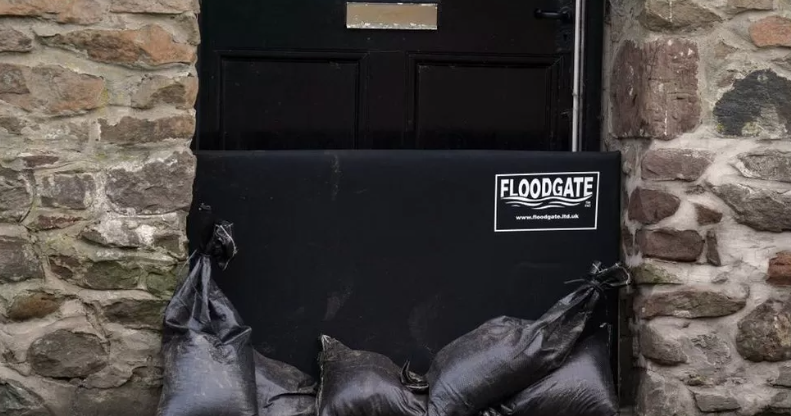
Aberdeenshire Council is urging residents to take advantage of sandbags to help protect properties. The local authority was holding a resilience meeting on Wednesday.
Perth and Kinross Council said it would close all of its floodgates on Wednesday, with the exception of those at the Queen’s Bridge.
The authority confirmed these will be installed on Thursday morning and the bridge will be closed to vehicles and pedestrians.
It will remain closed until the storm has passed, but council workers will be present at the gates to assist any businesses to pass through the gates when it is safe.
The authority was previously criticised over its delay in closing the North Inch floodgates during heavy rain and rising water levels earlier this month, which led to properties and businesses being flooded as a result.
The RNLI warned the strong winds that have been forecast along with heavy rain are likely to cause dangerous conditions for those visiting the coast around the UK and Ireland.
RNLI water safety partner Sam Hughes said: “The RNLI advises staying a safe distance away from the water and cliff edges as the conditions could knock you off your feet or wash you into the sea. It is not worth risking your life.”


